DXCC QSL Gallery
Caribbean DXCC Entities
United States DXCC Entities
Desecheo I.
Puerto Rico
Navassa I.
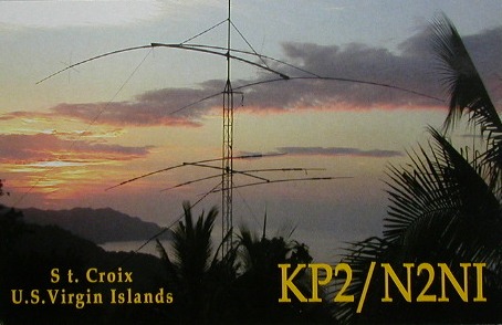
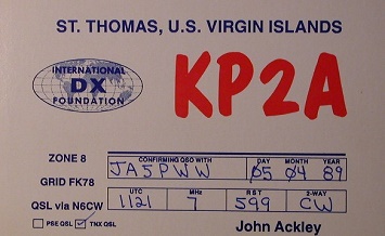
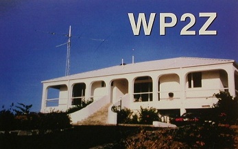
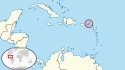
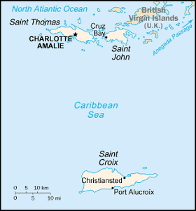
US Virgin Islands
・
・
Desecheo I.
Puerto Rico
Navassa I.
US Virgin Islands
Pacific Ocean
DXCC QSL Gallery
Caribbean DXCC Entities
United States DXCC Entities
中央アメリカ
南アメリカ
カリブ海
US Virgin Is.
イスパニョーラ島
国旗やバナー、ボタン、青色文字などをクリックすると簡単な紹介ページへ移ります。
JA
US Virgin Is.
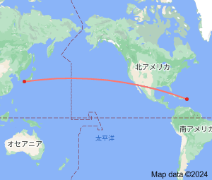
JA
から
USバージン諸島
の方位と距離
北東 約13,890km
・
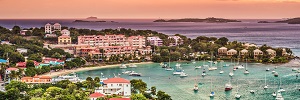
米国領バージン諸島
は、セント・トーマス島、セント・クロイ島、セント・ジョン島
の主要3島で構成され、首都はセント・トーマス島にあります。
、
Continent;NA CQ;08 ITU;11 18°34’North 64°90’West UTC-4 (JST-13)
アメリカ領バージン諸島
は、
プエルト リコ
の東に位置する
バージン諸島
の南が
アメリカ
の自治領、北に
イギリス領バージン諸島(VP2V)
があります。
U.S. Virgin Islands
are a group of
Caribbean
islands and an unincorporated and organized territory of the
United states
.
The islands are geographically part of the
Virgin Islands
archipelago and are located in the Leeward Islands of the Lesser Antilles
to the east of
Puerto Rico
and west of the
British Virgin Islands
.
JA5PWW
●「英国領バージン諸島」 「British Virgin Islands」
アメリカ領バージン諸島
英国領バージン諸島
)