Pacific Ocean
DXCC QSL Gallery
Barbados
Caribbean DXCC Entities
・
DXCC QSL Gallery
Caribbean DXCC Entities
Barbados
国旗やバナー、ボタン、青色文字などをクリックすると簡単な紹介ページへ移ります。
Barbados
JA
JA
から
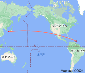
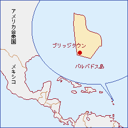
バルバドス
の方位と距離
北東 約14,600㎞
・
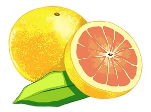
グレープフルーツは、
バルバドス
が原産地だそうです。
Continent;NA CQ;08 ITU;11 13°10’12”North 59°33’09”West UTC-4 (JST-13)
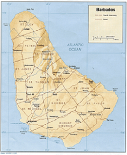
バルバトス
は、
小アンティル諸島
の東端に位置する国で、西は
カリブ海
、東は果てしない
大西洋
に面し、経済を支える柱は観光のようです。
Barbados
is an
island country
in the
Lesser Antilles
of the
West Indies
, in the
Caribbean
region of North America, and the most easternly
of the
Caribbean Islands
. It lies about 168 km (104 ni) east of both the countries of
Saint Lucia
and
Saint Vincent and the Grenadines
,
180 km (110 mi) southeast of
Martinique
and 400 km (250 mi) north-east of
Trinidad and Tobago
.
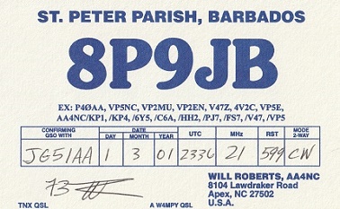
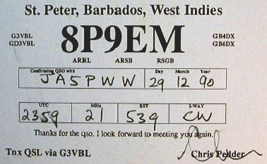
JA5PWW