Pacific Ocean
TOP
Honduras
DXCC QSL Gallery
DXCC QSL Gallery
Central American DXCC Entities
Honduras
ホンジュラス 中央アメリカのDXCCエンティティ DXCC QSL ギャラリー
国旗やバナー、ボタン、青色文字などをクリックすると簡単な紹介ページへ移ります。
JA
Honduras
JA からホンジュラス の方位と距離
北東 約13,130㎞
エル サルバドル
グアテマラ
ニカラグア
TOP ホンジュラス 中央アメリカのDXCCエンティティ DXCC QSL ギャラリー
●アメリカのDXCC消滅エンティティ(スワン諸島)  US Deleted DXCC Entities (Swan Islands)
ホンジュラス国名の由来
かのコロンブス来航時、海が深すぎて錨が降ろせなかったエピソードからスペイン語による「深い」を意味する
言葉(hondura)に由来しているそうです。(なおホンジュラスは英語表記です。)
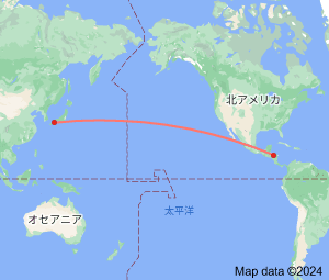
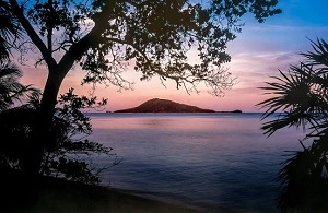
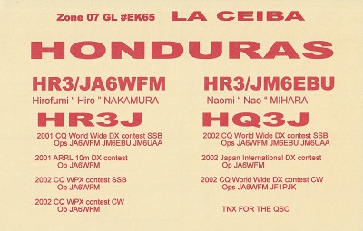
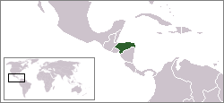
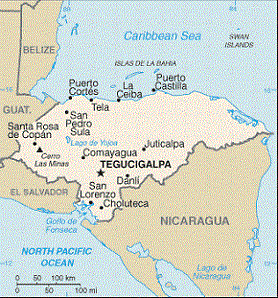
Continent;NA CQ;07 ITU;11     UTC-6 (JST-15)
中央アメリカ中部のホンジュラスは、太平洋側は山岳地帯、カリブ海側は平地が広がる地勢の国だそうです。
Honduras, officially the Republic of Honduras, is bordered to the west by Guatemala
, to the southwest by El Salvador, to the southeast
by Nicaragua
to the south by the Pacific Ocean at the Gulf of Fonsecam and to the north by the Gulf of Honduras, a large inlet of
the Caribbean Sea
.
ホンジュラス共和国 (通称 ホンジュラス) Republic of Honduras
JA5PWW
ホンジュラス