World Geography
・
Indian Ocean DXCC Entities
French DXCC Entities
Indian Ocean
Indian Ocean DXCC Entities
French DXCC Entities
国旗やバナー、ボタン、青色文字などをクリックすると簡単な紹介ページへ移ります。
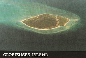
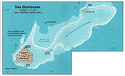
Glorioso Is
.
JA
Glorioso I.
JA
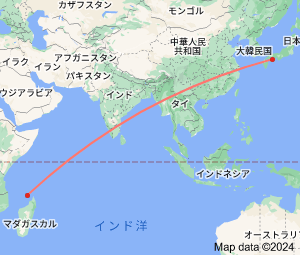
から
グロリオソ諸島
の方位と距離
西 約10,350㎞
この地図をクリックすると拡大します。
レユニオン島
モーリシャス
マヨット島
コモロ
・
クリックすると拡大します。
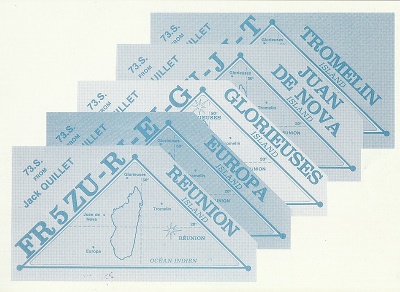
Tromelin I.
Juan de Nova & Europa Is.
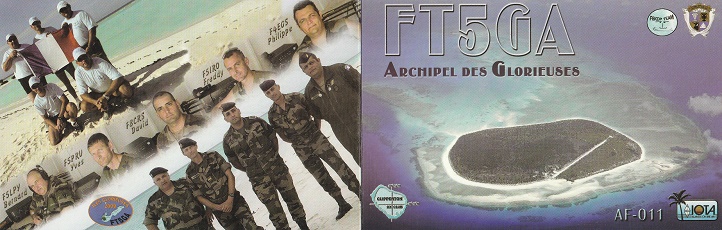
Glorioso Islands
are controled by
France
as part of the Scattered Islands in the
Indian Ocean
in the
French Southern and Antarctic Lands
, a
French overseas territory
.
They are geographically part of the
Comoro Islands
between the French overseas region of
Mayotte
and the nation of
Madagascar.
Continent;AF CQ;39 ITU;53 11°33 ′South 47°20 ′East
●「フランス領南方・南極地域」
「French Southern and Antarctic Territories」
●「フランスの海外県 マヨット島」
「Mayotte Island」
●「フランスの海外県 レユニオン島」
「Reunion Island」
●「フランスのDXCCエンティティ」
「French DXCC Entities」
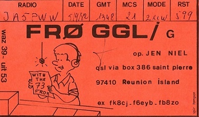
JA5PWW
DXCC QSL Gallery
Geography of Africa
DXCC QSL Gallery
Tromelin I.
Glorioso Is.
Juan de Nova & Europa Is.
Geography of Africa
・
モザンビーク
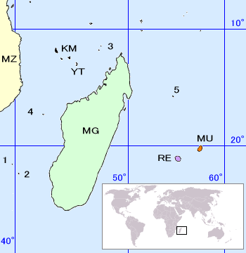
フランス領インド洋無人島群 French uninhabited Islands in the Indian Ocean
地図上のMZは、アフリカ大陸の
モザンビーク
(C9)、MGは
マダガスカル
(5R),KMは
コモロ
(D6)、YTは
マヨット島
(FH)、MUは
モーリシャス
(3B8)、REは
レユニオン島
(FR)を示しています。
フランス領インド洋無人島群
は、
フランス領南方・南極地域
を束ねるお役所の管理下にあるそうです。(左が同地域の旗印)
マダガスカル島
アフリカ
インド洋
マダガスカル
島の周囲に
フランス領インド洋無人島群
が点在し、
3か所のDXCCセパレートエンティティが存在します。(番号は左の地図上を示します。)
1、バサス・ダ・インディア(ここは殆ど水没場所のようです。)
2、
ユローパ島 Europa Island
3、
グロリオソ諸島 Glorioso Islands
4、
ファン デ ノバ島 Juan de Nova Island
5、
トロメリン島 Tromelin Island