TOP
●亜南極地域のDXCCエンティティ  Subantarctic Region DXCC Entity
Pacific DXCC Entitiesn
DXCC QSL Gallery
Macquarie Island
Australian DXCC Entities
Pacific Ocean
DXCC QSL Gallery
Australian DXCC Entities
Macquarie Island
マッコーリー島 オーストラリアのDXCCエンティティ 太平洋のDXCCエンティティ DXCC QSL ギャラリー
国旗やバナー、ボタン、青色文字などをクリックすると簡単な紹介ページへ移ります。
(ペンギンやアザラシの繁殖地です。)
●世界の面白い島や不思議な島  Interesting and Mysterious Islands of the World
JA
Macquarie I.
●亞南極地域のDXCCエンティティ   Subantarctic Region DXCC Entities
JA からマッコーリー島 の方位と距離
南 約10,140km
TOP マッコーリー島 オーストラリアのDXCCエンティティ 太平洋のDXCCエンティティ DXCC QSL ギャラリー
マッコーリー島は世界遺産に登録された最南端の島で、観測基地があります。
(隊員にアクティブなハムがいればよいのですが・・・・)
クリックすると拡大します。
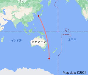
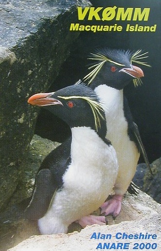
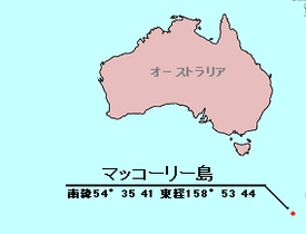
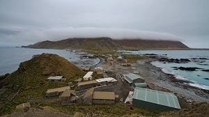
Continent;OC CQ;30 ITU;60  54°35’41”South  158°53’44”East     UTC+11 (JST+2)
マッコーリー島は、オーストラリアのタスマニア州に属し、狂う南緯50度の暴風にさらされる無人島でペンギンの大規模繁殖地になっているそうです。
Macquarie Island lies in the Southwestern Pacific Ocean, about halfway between
New Zealand and Antarctica. Regionally part of Oceania
and politically a part of Tasmania
, Australia and was inscribed on the World Heritage List in 1997.
マッコーリー島 (オーストラリア領) Macquarie Island (Australia)
JA5PWW