(Fenix Islands)
Fenix Islands
Central Kiribati
Central Kiribati
●オセアニア地域の島国やDXCCエンティティ  Oceania Countries and DXCC Entities
バナバ島
ナウル
パルミラ環礁
DXCC QSL Gallery
Pacific DXCC Entities
United States DXCC Entities
US Pacific Islands
Baker & Howland Islands
Baker & Howland Is.
ハワイ
ミッドウェー島
ジョンストン島
Pacific Ocean
DXCC QSL Gallery
US Pacific Islands
United States DXCC Entities
Pacific DXCC Entities
Baker & Howland Islands
ベーカー&ホーランド諸島 アメリカ太平洋諸島 アメリカのDXCCエンティティ 中央キリバス 太平洋のDXCCエンティティ DXCC QSL ギャラリー
国旗やバナー、ボタン、青色文字などをクリックすると簡単な紹介ページへ移ります。
JA
Baker & Howland Is.
JA からベーカー&ホーランド島 の方位と距離
東南 約6,430km
TOP ベーカー&ホーランド諸島 アメリカ太平洋諸島 アメリカのDXCCエンティティ 中央キリバス 太平洋のDXCCエンティティ DXCC QSL ギャラリー TOP
クリックすると拡大します。
Pacific Map
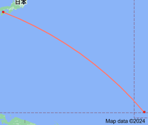
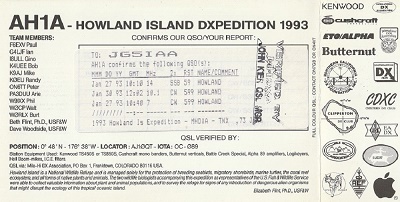
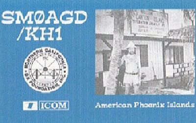
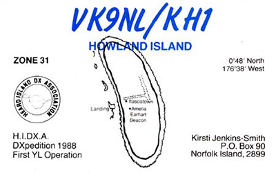
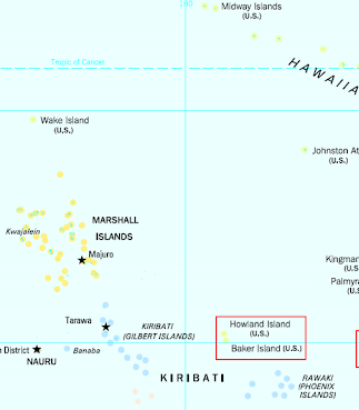
Continent;OC CQ;31 ITU;61  0°48’24”North 176°36’59”West    UTC-12 (JST-21)
ベーカー&ホーランド島は、赤道太平洋に位置するアメリカ領の無人島で、フェニックス諸島中央キリバス)の地理的グループの一部でもあるそうです。
Baker Island is an uninhabited atoll just north of the equator in the central Pacific Ocean about 3,090 km (1,920 mi) southwest of
Honolulu Hawaii
. Its nearest neighbor is Howland Island, 68 km (42 mi) to the north-northwest. Together with Baker Island it forms part of
the Phoenix Islands (Central Kiribati)
.
ベーカー&ホーランド島(米国領) Baker & Howland Islands (USA)
JA5PWW
マーシャル諸島
西キリバス
中央キリバス
ウエーク島