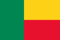
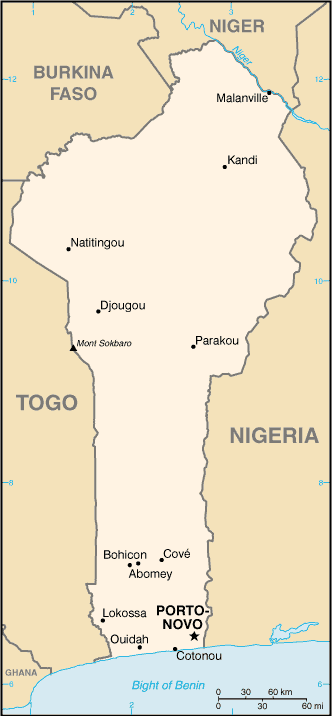
World Geography
World Geography
Benin
TOP
Gulf of Guinea
Benin
Western Africa
Benin
国旗やバナー、ボタン、青色文字などをクリックすると簡単な紹介ページへ移ります。
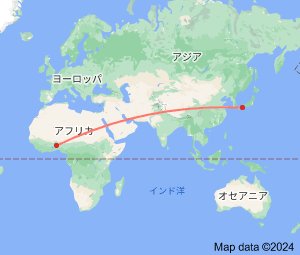
●西アフリカ地域の国とDXCCエンティティ  West African Countries and DXCC Entities
●ギニアいろいろ  About Guinea
 ・ギニア(地域)  Guinea Region)
 ・ギニア湾諸国  Gulf of Guinea Countries
●丸い国と四角い国、細長い国  Round and Square Countries,Long and Narrow Countries
 (ギニア湾岸の細長い国;ベナン
JA
Benin
JA からベナン の方位と距離
西北 約12,950km
●世界の国旗  Flags of the World
 (アフリカの色;緑黄赤)
●フランスの消滅DXCCエンティティ(フランス領西アフリカ)  France's Deleted DXCC Entities (French Western Africa)
Continent;AF CQ;35 ITU;46     UTC+1 (JST-8)
ベナン共和国 (通称 ベナン)  Republic of Benin
JA5PWW

DXCC QSL Gallery
Geography of Africa
DXCC QSL Gallery
Geography of Africa
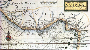
その昔の不幸な時代この辺り(ベナン、、ナイジェリア の西部)のギニア湾に面した海岸一帯は、奴隷貿易の中継地として「奴隷海岸」と
呼ばれていました。
TOP ベナン アフリカ地域の地理 DXCC QSL ギャラリー 世界の地理(目次)
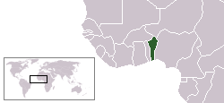
Benin, officially the Republic of Benin, is a country in West Africa. The, north-south strip of land between the equator
and the Tropic of Cancer. Benin formerly known Dahomey, is one of Africa's stable democracies.
旧称ダホメー共和国
ベナン西アフリカギニア湾に面し、西の隣国トーゴと同様南北に細長い国で、フランスから独立当初はダホメー共和国の名称で
呼ばれていました。(同国にはボードゥー教の聖地、奴隷貿易の史跡、アフリカ唯一の水上集落などがあるそうです。)
Benin (TY) is bordered by Togo (5V) to the west, Nigeria (5N) to the east, and Burukina Faso (XT) and Niger (5U) to the north.
ベナン アフリカ地域の地理 DXCC QSL ギャラリー 世界の地理(目次)