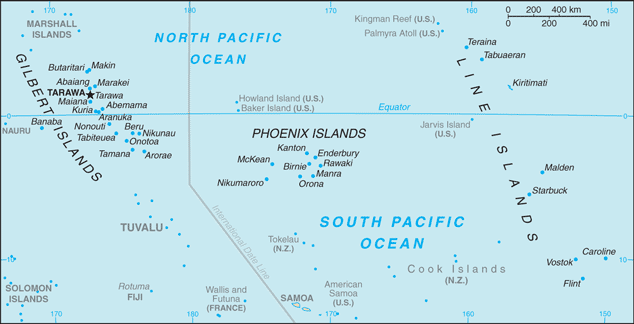
Line Islands
(Line Islands)
East Kiribati
East Kiribati
●オセアニア地域の島国やDXCCエンティティ Oceania Countries and DXCC Entities
DXCC QSL Gallery
Pacific DXCC Entities
United States DXCC Entities
US Pacific Islands
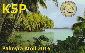
Palmyra & Jarvis Islands
パルミラ環礁
・
Pacific Ocean
DXCC QSL Gallery
US Pacific Islands
United States DXCC Entities
Pacific DXCC Entities
Palmyra & Jarvis Islands
国旗やバナー、ボタン、青色文字などをクリックすると簡単な紹介ページへ移ります。
JA
Palmyra & Jarvis Island (USA)
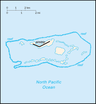
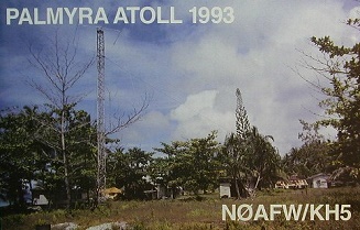
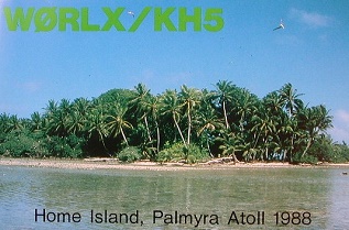
クーパー島
パルミラ環礁
がら電波が出る場合、環礁の中での中で最も大きなクーパー島からのようです。
この島は自然保護目的のNGOが所有する島になっているそうです。
Palmyra Atoll&Jarvis Is.
JA
から
パルミラ環礁&ジャービス島
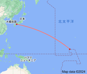
の方位と距離
東南 約5,970km
●赤道直下の国やDXCCエンティティ(ジャービス島)
Equatorial Countries and DXCC Entities(Jarvis Island)
●アメリカのDXCC消滅エンティティ(キングマン リーフ) US Deleted DXCC Entities (Kingman Reef)
・
キングマンリーフ
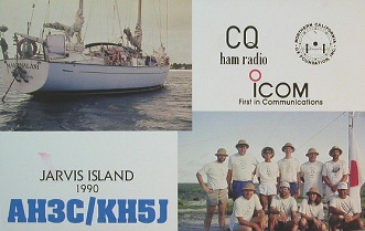
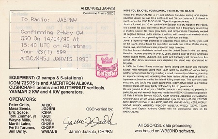
Jarvis Island
(0°2S’outh 160°0’West) is the largest of three
U.S. equatorial possessions
,
which include
Baker Island
and
Howland Island
.
クリックすると拡大します。
Continent;OC CQ;31 ITU;61,62 5°53’North 162°5’West UTC-10 (JST-19)
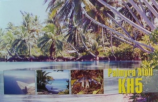
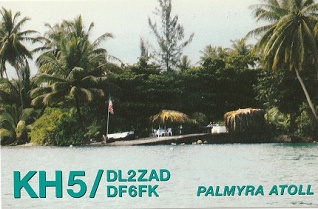
パルミラ環礁
は、
中部太平洋
にあり、
ハワイ諸島
の南南西約1,600 km に位置し
、
ライン諸島
に属しています。
Palmyra Atoll
is one of the
Northern Line Islands
,
located almost due south of the Hawaiian Islands, roughly one-third of the way
between
Hawaii
and
American Samoa
.
Jarvis island
is an uninhabited coral island located in the
South Pacific Ocean
, about halfway
between
Hawaii
and the
Cook Islands
.
クック諸島
JA5PWW
西キリバス
(ギルバート
諸)
中央キリバス(フェニックス諸島)
ジャービス島
東キリバス
(ライン諸島)
ベーカー&ホーランド島
パルミラ環礁