World Geography
World Geography
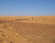
●世界の砂漠(サハラ砂漠) Desert of the World (Sahara Desert)
●中東及びアラブ世界 Middle East and Arab World
Middle East & Arab World
Middle East & Arab World
North Atlantic
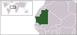
Northern Africa
Mauritania
Western Africa
Mauritania
・
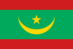
Mauritania
国旗やバナー、ボタン、青色文字などをクリックすると簡単な紹介ページへ移ります。
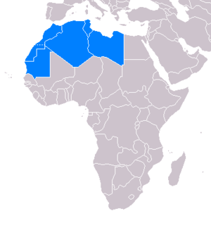
●北アフリカ地域の国とDXCCエンティティ North African Countries and DXCC Entities
●西アフリカ地域の国とDXCCエンティティ West African Countries and DXCC Entities
JA
Mauritania
JA
から
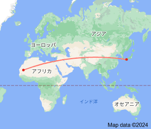
モーリタニア
の方位と距離
西北西 約12,820㎞
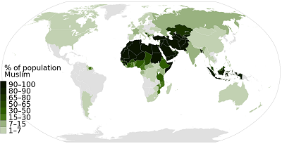
●イスラム世界 Islamic World
●マグリブ地方及びマシュリク地方の国 Maghreb and Mashriq Countries
●フランスの消滅DXCCエンティティ(フランス領西アフリカ) France's Deleted DXCC Entities (French Western Africa)
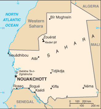
国土面積の9割がサハラ砂漠
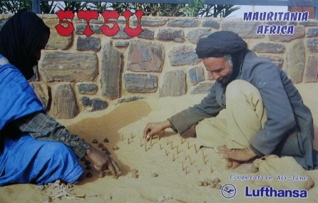
1970年代ある日本の漁業指導者の努力によってタコ壺漁の普及に成功し、現在の世界有数のタコ産地に発展したそうです。
Islamic Republic of Mauritania
Continent;AF CQ;35 ITU;46 UTC+9 (JST-9)
Mauritania
, officially the
Islamic Republic of Muritania
, is a country in Northwest Africa. Approximately 90% of Mauritania's land
is within the
Sahara
.
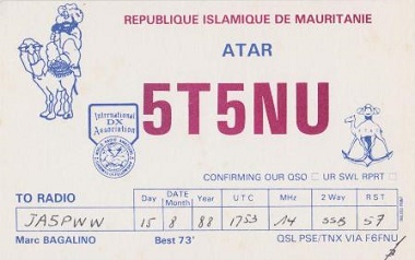
JA5PWW
・
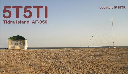
DXCC QSL Gallery
Geography of Africa
DXCC QSL Gallery
Geography of Africa
日本の裏側に位置する国で、日本向けタコの原産地。
アフリカ大陸の西側にある
モーリタニア
は、日本の約3倍の国土面積を持つがその9割以上を
サハラ砂漠
に覆われ可耕地は
僅か0.4%に過ぎない特異な国家だそうです。そして鉱業(鉄鉱石)が主要産業のようです。
Mauritania
is bordered by the
Atlantic Ocean
to the west,
Western Sahar
a
(S0) to the north and northwest,
Aligeria
(7X) to the northeast,
Mali
(TZ) to the east and southeast, and
Senegal
(6W) to the southwest.